Site Analysis & Selection

Property intelligence at portfolio scale

Site acquisition should be systematic, not reactive. Most teams still rely on broker relationships, ad-hoc spreadsheets, and disconnected GIS tools to find and qualify opportunities. Giraffe gives you the spatial intelligence to make confident decisions without the GIS overhead.

1

The Traditional Workflow

Site selection is typically fragmented across disconnected tools and consultants:

When a new opportunity arrives, the same manual process starts from scratch. That is slow. And expensive.

  • Broker relationships and ad-hoc deal flow
  • Disconnected GIS and mapping tools
  • Static spreadsheets for site comparison
  • Manual zoning and constraint checks
  • Separate consultants for environmental, infrastructure, and planning review
2

The Giraffe Approach

Giraffe aggregates global and local datasets into a single governed map — letting you screen markets, qualify sites, and build pipeline at scale.

Tens of thousands of data layers are already connected: zoning, ownership, flood plains, infrastructure, demographics, and more. Upload your own proprietary data or connect to internal systems. Everything lives on one map, filterable and queryable in real time.

3

What You Get

  • Your Portfolio and Your Market in One View — Build configurable portfolios and market maps across jurisdictions.
  • Qualify Sites in Minutes, Not Days — Automated constraint checks and red flag detection.
  • Draw, Measure, and Model on the Map — Design tools, 3D visualisation, and compliance assessment.
  • From GIS to GeoJSON — Universal import/export with API and SDK access.
LendleaseAECOMTrammell Crow CompanyNRP GroupHKSSummitNettleton TribeWSPNSW GovernmentWoods BagotMitsubishiArchitectus

Your Portfolio and Your Market in One View

If you operate in multiple markets or across different teams, build different portfolios and market maps. Fully configurable — tens of thousands of layers already connected, but you can add more.

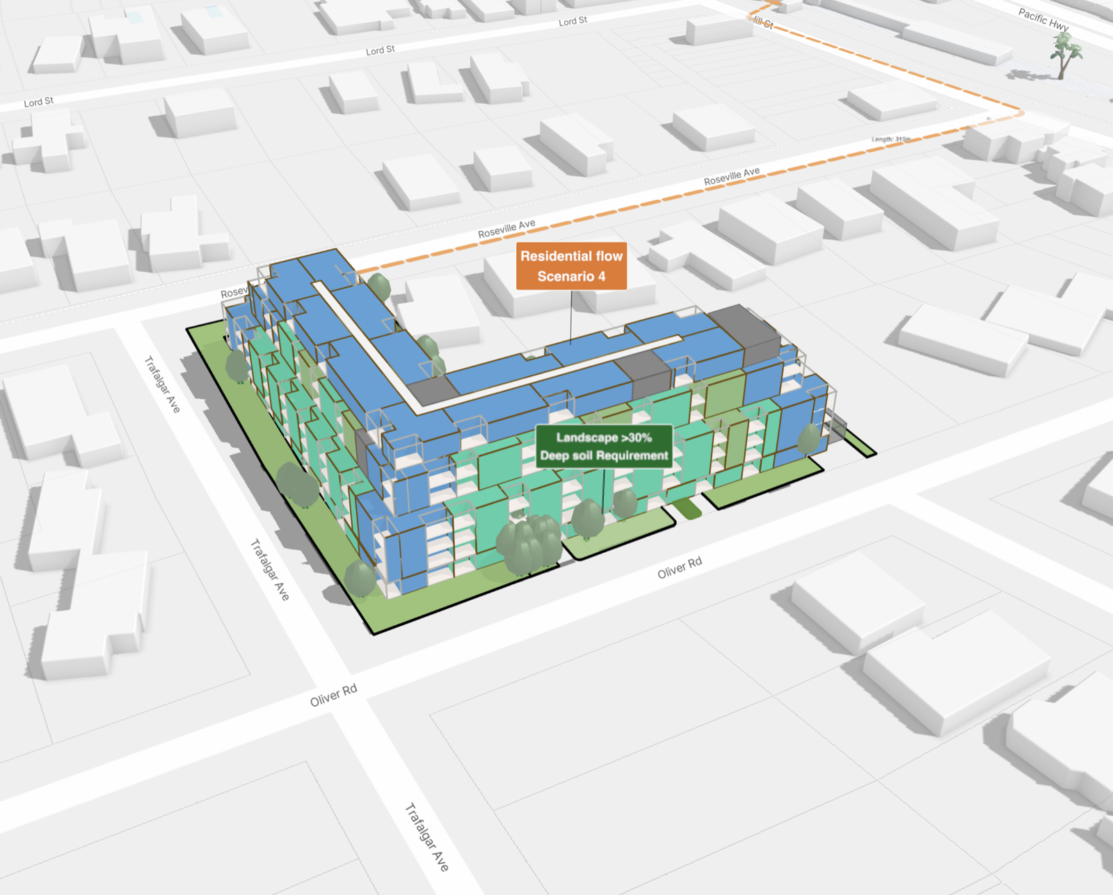
  • Stream zoning, ownership, flood plains, and infrastructure layers — and many more.
  • Run automated due diligence before engaging consultants.
  • Identify highest-and-best-use opportunities across markets.
  • Maintain portfolio-wide visibility in one shared workspace.

Qualify Sites in Minutes, Not Days

Run initial due diligence from your desktop. Review setbacks, easements, hazards, zoning conflicts, and infrastructure capacity before you spend on consultants. The Site Checker helps you identify red flags fast and focus your team on the opportunities that matter.

  • Automated Constraint Checks: Screen against zoning, environmental, and infrastructure parameters instantly.
  • Parcel Intelligence: Access ownership, boundaries, and planning data for any site.
  • Red Flag Detection: Surface deal-breakers early so your team focuses on viable opportunities.
Qualify Sites in Minutes, Not Days

Draw, Measure, and Model on the Map

Use familiar drawing tools to diagram, design, and annotate directly on the map. Master plans, test fits, site analysis — Giraffe makes it spatial and visual. Turn 2D shapes into 3D buildings, run solar and shadow analysis, and assess compliance against planning controls.

  • Interactive Design Tools: Draw, measure, and model without leaving the map.
  • 3D Visualisation: Extrude footprints into massing models with real-time shadow analysis.
  • Compliance Assessment: Check designs against zoning envelopes, setbacks, and height limits.

From GIS to GeoJSON — Built to Interoperate

Giraffe's core data format is GeoJSON — readable by GIS tools, Python, JavaScript, and AI models. Import CAD, PDF, survey data, and shapefiles. Export to DXF, IFC, STL, and OBJ. Giraffe fits into your existing tech stack, not the other way around.

  • Universal Import: CAD, PDF, shapefile, GeoJSON — bring data from any source.
  • Flexible Export: DXF, IFC, STL, OBJ, and structured JSON for downstream systems.
  • API & SDK Access: Programmatic access to every layer, project, and computation.

Ready to see how Giraffe can work for your team?

Talk to us