Real Estate Data Platform

The Infrastructure for Your Portfolio

Most real estate data is trapped in static PDFs, disconnected spreadsheets, and isolated CAD files. This fragmentation creates risk and slows capital deployment. Giraffe provides the Spatial Data Infrastructure that unifies your proprietary assets with global datasets into a single source of truth.

1

The Traditional Workflow

Real estate data management is typically fragmented across teams and tools:

When assumptions change, there is no single source of truth — just a folder of files.

  • Static PDFs and reports from consultants
  • Disconnected spreadsheets with no shared schema
  • Isolated CAD files that cannot be queried or compared
  • Local GIS tools that require specialist skills
  • No version control, no audit trail, no governance
2

The Giraffe Approach

Giraffe gives your team a live database of your entire pipeline — searchable, scalable, and machine-readable. Every polygon carries structured metadata. Every feasibility study follows the same governed schema. Every dataset is versioned, permissioned, and ready for computation.

Whether you operate across one market or twenty, Giraffe replaces the folder of files with a governed spatial data platform.

3

What You Get

  • A Unified Real Estate Ontology — Smart objects that encode building logic in a standardised schema.
  • Spatial Data Infrastructure — Stream high-density spatial data without local GIS overhead.
  • Open Extensibility — JavaScript SDK, REST APIs, and webhook integrations.
  • Enterprise Governance — Role-based access, audit trails, and SOC/ISO 27001 compliance.
LendleaseAECOMTrammell Crow CompanyNRP GroupHKSSummitNettleton TribeWSPNSW GovernmentWoods BagotMitsubishiArchitectus

A Unified Real Estate Ontology

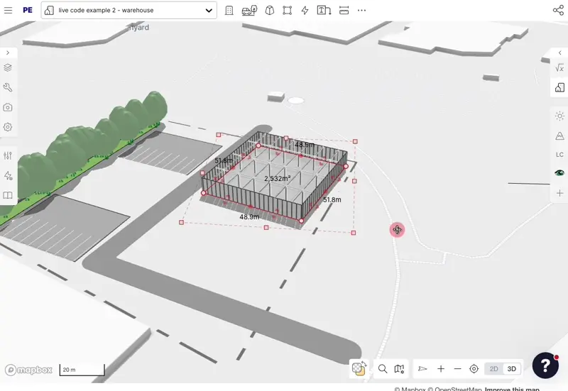
Giraffe does not just store shapes — it encodes building logic. Our core ontology standardises how spatial data and financial data interact across your organisation.

  • Smart Objects: Every polygon carries structured metadata — areas, unit counts, cost assumptions, carbon metrics.
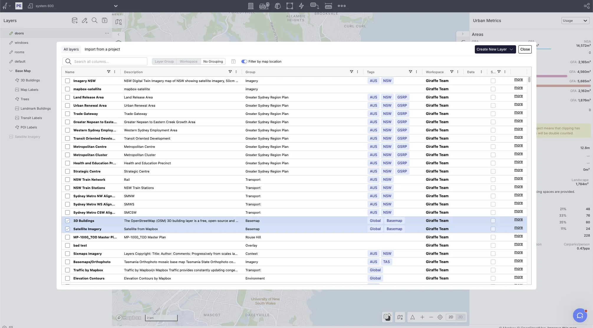
  • Global Schema: A feasibility study in London follows the same data structure as a project in Sydney, enabling portfolio-wide benchmarking.
  • Versioned State: Every change is tracked. Roll back, compare, and audit at any point.
A Unified Real Estate Ontology

Spatial Data Infrastructure

Stream high-density spatial data without local GIS overhead. Giraffe connects to WFS, WMS, and XYZ tile services natively, rendering thousands of parcels and complex geometries in a browser-native environment.

  • Host proprietary datasets securely alongside market data.
  • Connect to tens of thousands of public data layers across jurisdictions.
  • Render, query, and filter spatial data in real time.
Spatial Data Infrastructure

Open Extensibility

Giraffe is built to be extended. The Developer SDK lets your team build custom tools, generative agents, and automated workflows on top of the core spatial engine.

  • JavaScript SDK: Full programmatic access to the geometry engine, data layers, and project state.
  • REST APIs: Sync with CRM, ERP, and BI systems bidirectionally.
  • Webhook Integrations: Trigger external processes from spatial events.

Enterprise Governance

Data without governance is a liability. Giraffe provides the controls your organisation needs to operate at scale.

  • Role-Based Access: Control who sees, edits, and exports at project and layer level.
  • Audit Trails: Full history of every assumption, edit, and output.
  • SOC & ISO 27001: Enterprise-grade security infrastructure.
Enterprise Governance

Ready to see how Giraffe can work for your team?

Talk to us